
How to guides
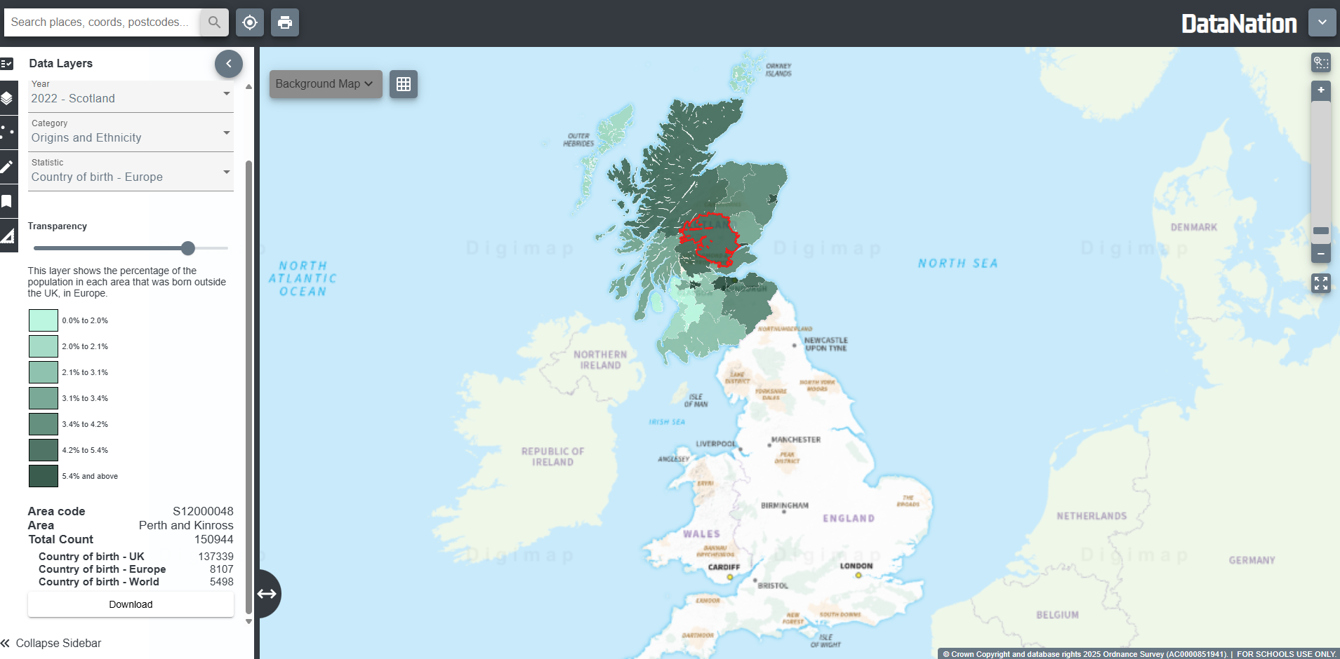
Data Layers
The Data Layers menu in the sidebar allows you to apply Census data directly to your map. DataNation currently includes census results from:
- 2011 (UK)
- 2021 (England & Wales)
- 2022 (Scotland)
Viewing Data Layers
- Open the Data Layers menu in the sidebar.
- Use the Year drop-down menu to choose the census year you want to view (2011, 2021, or 2022).
- Use the Category drop-down menu to select the type of data (e.g. Population, Housing, Education).
- Use the Statistic drop-down menu to select the specific dataset within that category.
- NOTE: You can only view one layer at a time. Every time you click on one layer, that layer will automatically replace the previous one.
- The chosen layer will appear on the map.
- Adjust the transparency slider to blend the data overlay with the background map.
- Click on an area of the map to view details from the original census dataset.
Available Layers
2011 Census Layers (UK)
Households
This layer shows data categorizing households based on the relationships among household members, number of dependent and access to amenities such as internet, broadband and cars in the United Kingdom as of the census day, March 27, 2011.
Housing
This layer shows data categorizing households based on tenure and accommodation type for in the United Kingdom as of the census day, March 27, 2011.
Population
This layer shows 2011 estimates of the usual resident population, population density and geographical area in the United Kingdom as of the census day, March 27, 2011.
Labour market
This layer shows 2011 estimates of the usual residents aged 16 to 74 by economic activity and approximated social grade in the United Kingdom as of the census day, March 27, 2011.
Origins and Ethnicity
This layer shows 2011 estimates of the usual residents by country of birth in the United Kingdom as of the census day, March 27, 2011.
Education
This layer shows 2011 estimates of the usual residents aged 16 and over by their level of qualification in the United Kingdom as of the census day, March 27, 2011.
Health
This layer shows 2011 estimates of the usual residents by long-term health problems or disabilities in the United Kingdom as of the census day, March 27, 2011.
Area characteristics
This layer is an official classification created by the Office for National Statistics (ONS) and University College London (UCL) from the 2011 Census data. It indicates the character of local areas and is known as Output Area Classification. It is a hierarchical classification that classifies areas in subgroups, groups and supergroups.
2021 (England & Wales) and 2022 (Scotland) Census Layers
Households
This layer shows data categorising households based on the relationships among household members (e.g. single-person, families, couples) and car or van ownership in the United Kingdom as of census day, March 21, 2021 (England and Wales) and March 20, 2022 (Scotland).
Housing
This layer shows data categorising households by tenure (owned, privately rented, socially rented) and accommodation type in the United Kingdom as of census day, March 21, 2021 (England and Wales) and March 20, 2022 (Scotland).
Population
This layer shows estimates of the usual resident population and population density in the United Kingdom as of census day, March 21, 2021 (England and Wales) and March 20, 2022 (Scotland).
Labour Market
This layer shows estimates of the usual residents aged 16 and over by economic activity (employed, unemployed, retired) in the United Kingdom as of census day, March 21, 2021 (England and Wales) and March 20, 2022 (Scotland).
Origins and Ethnicity
This layer shows estimates of the usual residents by country of birth and ethnic group in the United Kingdom as of census day, March 21, 2021 (England and Wales) and March 20, 2022 (Scotland).
Education
This layer shows estimates of the usual residents aged 16 and over by their highest level of qualification in the United Kingdom as of census day, March 21, 2021 (England and Wales) and March 20, 2022 (Scotland).